Zeitpunkt              Nutzer    Delta   Tröts        TNR     Titel                     Version  maxTL
So 02.06.2024 00:00:38       613       0      126.292   206,0 kirche.social             4.2.8      500
Sa 01.06.2024 00:01:40       613      +1      126.194   205,9 kirche.social             4.2.8      500
Fr 31.05.2024 00:00:35       612       0      126.099   206,0 kirche.social             4.2.8      500
Do 30.05.2024 00:00:26       612       0      126.037   205,9 kirche.social             4.2.8      500
Mi 29.05.2024 00:00:34       612       0      125.930   205,8 kirche.social             4.2.8      500
Di 28.05.2024 00:00:33       612      -1      125.851   205,6 kirche.social             4.2.8      500
Mo 27.05.2024 00:00:35       613       0      125.814   205,2 kirche.social             4.2.8      500
So 26.05.2024 00:00:36       613       0      125.770   205,2 kirche.social             4.2.8      500
Sa 25.05.2024 00:00:29       613       0      125.696   205,1 kirche.social             4.2.8      500
Fr 24.05.2024 00:00:43       613       0      125.631   204,9 kirche.social             4.2.8      500
Uli (@infoleck) · 03/2019 · Tröts: 3.968 · Folger: 334
So 02.06.2024 13:01
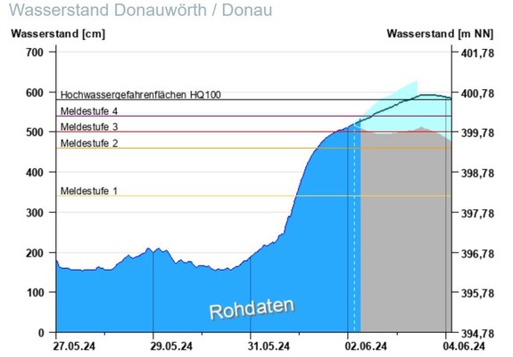
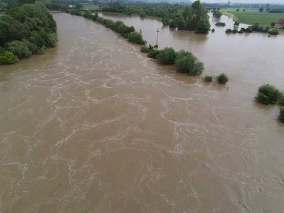
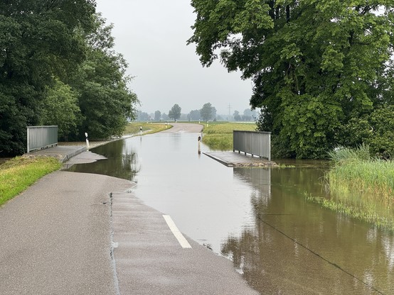
Gegenüber gibt die Feuerwehr OT Berg #Sandsäcke an Privatleute ab: pro Haushalt 10 Stück. Das Krankenhaus #Donauwörth und einige OT wurden/werden z.T. evakuiert. Der Peak des #Hochwasser soll hier erst morgen erreicht werden. Weite Gemeindeteile sind bereits überflutet. Flussdeiche sind durchnässt und lecken bereits bedrohlich. Die Feuerwehren sond pausenlos im Einsatz. #klimanotstand #hq100 #climatechange #klimakatastrophe #dankedenhelfern

Graph of water levels in Donauwörth/Donau from 27.05.24 to 04.06.24, showing rising levels reaching peak around 02.06.24 and categorized alert stages. From: Hochwassernachrichtendienst Bayern/Landesamt für Umwelt

Aerial view of a flooded river overflowing its banks near Donauwoerth, with trees and vegetation partially submerged in the water.

A flooded rural road near Donauwoerth surrounded by trees and grass, with water covering the pavement and part of the sidewalk.
[Öffentlich] Antw.: 0 Wtrl.: 1 Fav.: 0